
Pick an MRT start that fits your walk
| Start | What to do there | Access and exit plan |
|---|---|---|
| King Albert Park MRT Exit A | See the conserved Bukit Timah Railway Station and nearby railway features. Use it for a short out-and-back or add a northbound trail section. | NParks puts the landscaped corridor entrance about a 5-minute walk along Bukit Timah Road from the exit. The station node has a sheltered yard and public toilets. |
| Hillview MRT Exit B | Start on Hillview Bridge or use it as a northern exit from a longer walk. | Follow the ramp or use the lift described by NParks. The station and 9 Mile Platform provide nearby toilet options. |
| Kranji MRT | Use the northern node for a short loop or set off south towards the Hillview section. | Cross the pedestrian overhead bridge. NParks lists lifts at both ends and a wheelchair-accessible Kranji node. This does not describe the full trail surface further south. |
Match the route to the surface and return trip
Short heritage visit: use King Albert Park Exit A, go to the former station and return by the same signed approach. This gives you one transport leg and avoids committing to a long stretch of trail.
Northbound walk: use the official access map and choose an exit before setting out. Parts of the Rifle Range Road to Kranji stretch use grass and gravel. A route that starts at a step-free station entrance can still include uneven ground. For a stroller or mobility aid, plan a short section whose surface you can confirm, and turn back before the route becomes unsuitable.
Southbound walk: set a reachable exit above the closed section or follow the designated diversion. The former railway alignment is about 24km as a whole, but the heritage alignment length is different from the number of kilometres available for an uninterrupted walk today.
South closure between Henderson Road and Spooner Road
NParks’ visit page identifies the closure as the section after Henderson Road and before Spooner Road for Phase 2 works. Its FAQ gives a target completion date of 31 July 2027. Use the marked alternative route outside the Rail Corridor, and consult the current NParks access maps and notices on the day. A projected completion date is not an announced reopening.
Daylight, water and trail etiquette
Bring drinking water and use station or node toilets before starting a longer section. Share the trail at a slow speed near walkers, follow signs and stay on the marked trail. NParks lights only selected approaches and amenities. Plan to exit before dark and reassess the route after heavy rain, especially if a grass or gravel stretch is part of your plan.
Make the walk reversible when fitness levels differ
Use the NParks access-point map to choose a trail entrance and a specific re-entry point to the road network. For a mixed-pace family, walk from the former railway station towards the next signed landmark and agree to turn back at a fixed time. A shuttle or pickup arranged for a verified road entrance makes a one-way walk easier. The green line on a map can cross a road without providing direct access there.
Choose a first Rail Corridor route by how you want to finish
| What you want | Start and finish | What makes it work |
|---|---|---|
| The restored railway station and a short walk | King Albert Park MRT, then the former Bukit Timah Railway Station and back. | See the heritage buildings and signs even if you decide against a longer walk. Add a section of trail after looking at the surface. |
| One useful access point for wheels | Hillview MRT Exit B and the Hillview Bridge ramp or lift. | Start at the entrance with a known accessible route. Check the next section of trail separately. |
| Heritage, then a food stop | Choose the station node before a continuation towards The Rail Mall and Hillview. | Use the official central and northern maps together. Decide where to exit before you start and bring enough water for the section between stops. |
| A longer route in the north | Check the Kranji access and the first crossing in your intended direction. | Confirm available paths and toilets on the dedicated north map. Leave a fallback via the same station if an onward point is inaccessible. |
Plan by confirmed entrances instead of promising a fixed number of kilometres. Two trails with similar length can feel different if one includes a hot road crossing or a stretch made slower by rain. Give each person the exit they should use if you separate. If your group will walk one way, finish near an agreed station or public road pickup point, even when this entails leaving the corridor before the end of a longer segment.
What you can see at Bukit Timah Railway Station
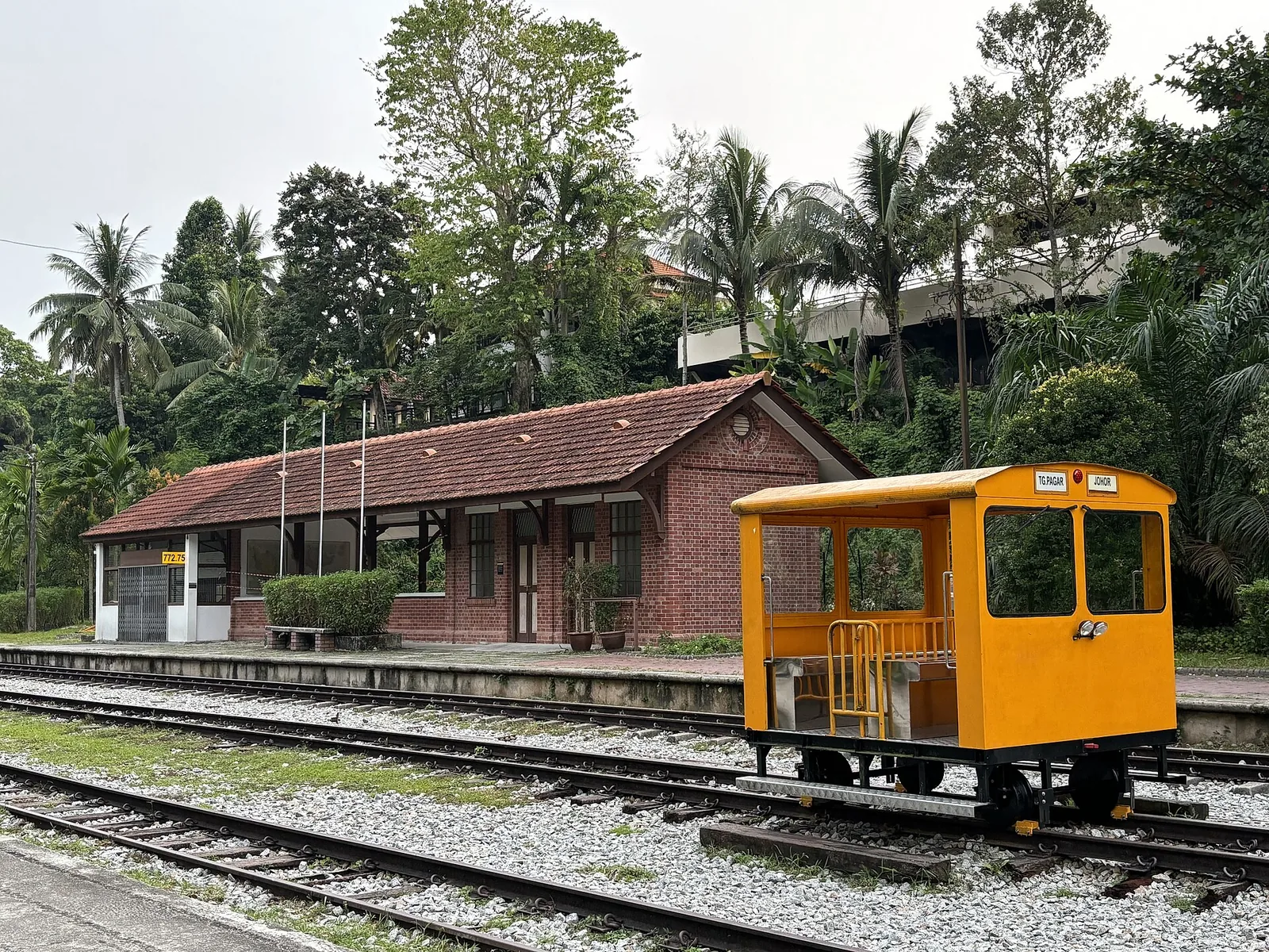
The NParks heritage site guide dates the conserved station building to 1932. The former Railway Staff Quarters next door used to house railway workers. The two buildings have different uses today. Look around the station gallery first, then use the quarters for the café if it is open and you want to stop. For a child who is mainly interested in trains, give them time to spot the station sign, the replica railway wagons and the switching levers.
The station guide says the Signal Room can be seen from the entrance. Look for equipment that would have helped staff manage train movements, including the restored track switching levers and a replica signalling diagram. Stay in the permitted space and follow the barrier and staff instructions. Outside, compare the railway objects along the platform area with the trail you just walked. It gives the path a different scale when you can picture how people once boarded a train there.
NParks says to turn left out of King Albert Park MRT Exit A and continue about five minutes on Bukit Timah Road to the landscaped approach. Start by confirming this named entrance if your group is using maps from different apps. The authority says there is no carpark at the station node. Arranging to meet there through public transport can be simpler than searching for a nearby drop-off at the last minute. If you are bringing older visitors, start with a short visit to the node and choose the onward section together.
Surface, lift and toilet checks between Bukit Timah and Hillview
The central access map distinguishes trail entrances, restored stairs, ramps and links to other nature sites. Match the actual marker on the map to the road you are using. If a path is accessible but the bridge approach uses steps, look for another marked road connection. An official description of one station node or bridge applies to that facility. Check any following section by ground type and grade.
At Hillview, the NParks northern guide says visitors can take the lift from MRT Exit B to Hillview Bridge. It lists toilets at the station and at the 9 Mile Platform near the Upper Bukit Timah Truss Bridge. The guide also describes a pedestrian overhead bridge linked to The Rail Mall. Check the connection and its facilities if a toilet or rest stop will decide how long you can walk. If you enter from Hillview, establish the return route first before turning onto the longer trail.
Keep a second plan after rain. A level section can still be uncomfortable with soft patches, pooled water or narrow gaps where people pass. Try a short surface test near the entrance. If the first section is too wet for a stroller or mobility aid, move to the station heritage stop or a nearby surfaced public route. Use daylight. NParks leaves most of the corridor unlit to support nocturnal animals, although there is some lighting at named access points and at the station node.
A one-way walk with a daylight cutoff
Work backwards from where you need to be at the end. A half-day can be spent around one rail station and a nearby heritage or food stop. If you want to reach a more distant station, mark the next public exit as the point where you decide whether to shorten the route. Include the last approach to the road in your time estimate. Someone walking slowly may need as much margin for that exit as for another trail segment.
For a southern route, download the NParks closure and diversion notice before going. The current page has a map of phased works and access points between Henderson Road and Spooner Road. Use the published alternative where applicable and obey signs on the ground. If you cannot verify both sides of a diversion, take a shorter route that ends before the blocked section. Avoid depending on an unlit continuation after sunset, particularly if there is a road pickup to find.
For a group cycling the corridor, select a place to pause away from the travel path and agree where the fastest riders should wait. Slow down at crossings and where walkers have limited space. Leave room to adjust the return route when the trail is busy or when rain changes the surface.
For a heritage day you can split between indoor and outdoor visits, the NParks central access map marks the Former Ford Factory along the Upper Bukit Timah corridor. Look up the actual venue approaches and current hours in our Singapore history guide before using the former railway as a connection. Start with the museum if you have a fixed admission window. Keep a shorter corridor section as the part you can move if rain arrives.
Sources
- NParks Rail Corridor visit guideAccess maps, surfaces, overall alignment and closure notice.
- NParks Rail Corridor South closure FAQWorks phase, alternative route guidance and expected end date.
- NParks Bukit Timah Railway Station guideKing Albert Park approach, station and yard facilities.
- NParks Rail Corridor North guideKranji and Hillview access, lifts and toilets.
- NParks Rail Corridor central access-point mapTrail surfaces and route access points