
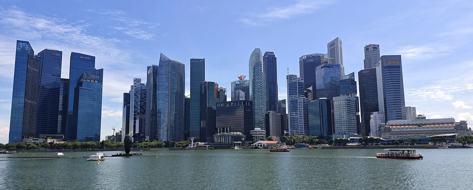
Where is the CBD in Singapore?
CBD stands for Central Business District. The Urban Redevelopment Authority defines it around Raffles Place, stretching along Shenton Way, Robinson Road and Cecil Street to Tanjong Pagar and Anson, with the Marina Bay Central and Bayfront subzones on the waterfront side. Use URA’s official map if you need an address-level boundary.
You will also see the term Downtown Core. That planning area contains the CBD along with places such as City Hall, Bugis, Marina Centre and Nicoll. For a meeting, hotel or delivery, use the full street address and nearest station. A label like “downtown” or “Marina Bay” can cover different sides of the waterfront.
Which MRT station should you use?
| Destination | Station | What to check before leaving |
|---|---|---|
| Raffles Place square and Market Street | Raffles Place (EW14/NS26) | Choose the square or building exit on the station map. Several passages surface on different streets. |
| Marina Bay Financial Centre | Downtown (DT17) | Search by tower number. Use the building’s instructions if your meeting is inside the office complex. |
| Lau Pa Sat and Telok Ayer Street | Telok Ayer (DT18) or Shenton Way (TE19) | Choose Telok Ayer for the shophouses, or Shenton Way if you are already on the Thomson–East Coast Line. |
| Guoco Tower and Anson Road | Tanjong Pagar (EW15) | Guoco Tower connects to the station. Some Anson Road offices have a longer surface walk, so verify the block number. |
| URA Singapore City Gallery and Maxwell Food Centre | Maxwell (TE18) | Maxwell is useful for the edge of the CBD around Maxwell Road and Chinatown. |
| Marina Bay Sands and its side of the waterfront | Bayfront (DT16/CE1) | Use Bayfront for the resort and convention centre. Use Downtown for the financial-centre side of the bay. |
A 45–75 minute walk from Raffles Place to Tanjong Pagar
- Start at Raffles Place square. Come out to the open square and walk toward Market Street. This is the quickest stop for the dense cluster of bank headquarters. CapitaSpring’s public gardens are a possible weekday detour if you have a booking and enough time.
- Continue to Lau Pa Sat at 18 Raffles Quay. Go inside to see the octagonal cast-iron market hall, dating to 1894. The hall was dismantled during MRT construction and subsequently reassembled. Give yourself extra time for food. The hawker centre runs around the clock and individual stalls set their own hours. For satay on the street, use the operator’s current Satay Street hours.
- Cross toward Telok Ayer Street. Walk south past the shophouses and heritage buildings, including Thian Hock Keng at 158 Telok Ayer Street. Today’s inland street was once on the waterfront, before reclamation moved the shoreline. For a quick pause, take the slower stretch through Telok Ayer before rejoining the office blocks near Tanjong Pagar.
- Finish at Guoco Tower. Look up from the public Urban Park at the foot of the tower, or use its covered plaza for a break. Continue to Tanjong Pagar MRT from the complex.
The time estimate allows for short photo stops. Add time for a meal or a museum visit. In heavy rain, cut the route to one stop near Raffles Place or Guoco Tower. If you have around 20 minutes, walk from Raffles Place to Lau Pa Sat and finish at Telok Ayer MRT.
Choose the experience by time of day
Weekday lunch: Visit Lau Pa Sat before or after the busiest office lunch period if you have flexibility. Start with the food hall itself, where you can walk the stalls and find a table before ordering.
Weekday afternoon: Pair Market Street with the public gardens at CapitaSpring. Our guide to Singapore’s tallest buildings gives the garden booking windows and a ground-level alternative.
Evening or weekend: Choose the outdoor waterfront or a food stop with hours you can confirm. For water-level skyline views, take the Raffles Place route to Merlion Park. For a planning and scale-model stop at Maxwell Road, check URA’s Singapore City Gallery opening and revamp information before going.
Singapore City Gallery renovation from December 2026
The URA gallery at 45 Maxwell Road is scheduled for a partial closure from 1 December 2026 to 30 April 2027. Full closure is scheduled from 1 May 2027, with a refreshed gallery expected in the final quarter of 2027. Check the URA visit page for accessible areas or reopening updates before adding it to a route.
Use the street address to pick a station and meeting point
Ask for the building name, street number and tower if one is used. On the same strip of waterfront, one invitation might say Marina Bay Financial Centre and another might say Marina Bay Sands. Start with Downtown station for an MBFC address and Bayfront for the resort or convention centre. If the meeting organiser says “Marina Bay MRT”, confirm whether they mean the station of that name or the general area.
For Raffles Place, use the plaza as an outdoor meeting point if everyone knows the closest station. If the group is headed inside a building, share the lobby or entrance name. Some buildings have entrances on two streets or a separate lift lobby for the upper floors. An address might take you to the correct building with the meeting room still several levels away. Give a first-time visitor the building’s directions and time for lobby or visitor registration.
If you are meeting at Guoco Tower before a meal, use the building’s travel directions and agree to meet at the Urban Park or a named shop. Someone arriving at Tanjong Pagar MRT can use this as a landmark. A driver should have the drop-off address for the destination and a place passengers can wait if they arrive early.
Choose one extra loop for a longer visit
River and skyline. Start at the Raffles Place end of the CBD and go towards the Fullerton waterfront. Use the Merlion Park guide to locate the statue and choose a public view towards Marina Bay Sands. Continue only as far as the group has time to return. If everyone is taking the MRT afterwards, choose the station you want to finish near before doing the long waterfront stretch.
Market and the former waterfront. Start at Lau Pa Sat and then continue towards Telok Ayer Street. Compare the market’s cast-iron roof and open sides with the temples and shophouses near Thian Hock Keng. The heritage record for Thian Hock Keng helps explain where early arrivals encountered the shoreline. Follow the shophouses towards the Maxwell side where the street leads into the edge of Chinatown. Check individual buildings separately if you want to go inside.
Office towers and late-day photos. Visit the core near Raffles Place or Shenton Way first, then decide whether to take one view across the water or finish near the tower you came to see. A photo at the foot of a tower emphasises height and detail. A distant spot on the bay lets you see the group of towers within the skyline. Compare these approaches in the Singapore skyline guide, especially if the group only has half an hour.
Keep the route usable in heat or rain
When the weather changes, decide which part of the visit needs to happen outdoors. The easiest way to protect a short lunch or meeting is to group it around one station instead of depending on a continuous sheltered walk between downtown districts. Check the visitor directions for each building and keep a surface route in mind. Entrances and indoor passages may have their own hours or access rules.
For visitors looking for a step-free route, verify both the lift at the station exit you need and the next crossing or entrance on the surface. An exit beside a landmark can still lead to the wrong side of a busy road. Use the operator’s map for the station and ask the building about its accessible lobby. An outdoor photo stop can sit after the meal or be dropped if the group is tired.
If your time is fixed, do the activity with a booking first and build one loose stop around it. A booked garden visit or appointment has a fixed entry point. A walk past the old market, a photo at the waterfront and a meal from a stall can have different hours and waiting times. Keep your train or taxi meeting point by the last activity so you have fewer cross-district steps when leaving.
Read the map as a visitor, even if your address says downtown
URA uses the Downtown Core for planning. For finding a specific place, use the address on the business’s own listing. A shopping stop near City Hall, an office on Robinson Road and an evening show at Bayfront can all appear in a broad search for downtown Singapore. Check the starting station for each before you put them in one block of your itinerary. If you need the official planning boundary for research or an address check, use the URA map.
Look at the ground floor as well as the skyline
On the walk from Market Street to Telok Ayer, pause where the scale changes. The old market serves people at a single open level, and the newer office buildings can have lift lobbies, retail entrances and public open space at different levels. Comparing the entrances helps explain why a nearby address can have several possible approaches from the same station.
Find Singapore Land Tower at 50 Raffles Place
Singapore Land Group lists Singapore Land Tower at 50 Raffles Place, Singapore 048623. If you are coming by MRT, use Raffles Place station and check the building name on the way out. For a meeting, take the floor, company name and visitor instructions from your invitation. A building with several occupants can have different check-in and lift arrangements by tenant.
Use the full pin if you are sending someone to the building by car or arranging a drop-off. Confirm any step-free route or visitor entrance with the building or host. Nearby offices also use Raffles Place addresses, so match the street number as well as the tower name. If your group wants an outdoor meeting point before going inside, use the Raffles Place square and allow time to walk to number 50.
Sources
- URA Downtown Core and CBD design guidelinesDowntown Core and CBD planning context
- URA Downtown Core boundary planAddress lookup and planning-area boundary
- URA’s Downtown Core guidelines PDFCBD extent and constituent subzones
- LTA rail system mapCBD MRT station names, lines and codes
- Lau Pa Sat and Satay StreetFood hall address, operator hours and Satay Street
- National Heritage Board on the former Telok Ayer MarketMarket building date, relocation and conservation
- National Heritage Board on Thian Hock KengHistoric shoreline along Telok Ayer Street
- Guoco Tower directionsDirect access from Tanjong Pagar MRT
- Guoco Tower Urban ParkPublic green space and covered plaza
- URA Singapore City Gallery visit informationVisitor information and renovation schedule
- Singapore Land Group Singapore Land Tower portfolioOfficial property address and CBD location.